
Dyke Stone, Gosforth
Introduction
The photograph on this page of Dyke Stone, Gosforth by Phil Thirkell as part of the Geograph project.
The Geograph project started in 2005 with the aim of publishing, organising and preserving representative images for every square kilometre of Great Britain, Ireland and the Isle of Man.

There are currently over 7.5m images from over 14,400 individuals and you can help contribute to the project by visiting https://www.geograph.org.uk
Dyke Stone, Gosforth
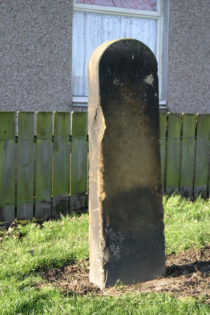
Image: © Phil Thirkell Taken: 30 Dec 2006
The Dyke Stone is situated at the eastern end of Aidan Walk. The inscription reads: "Main Dyke distance from Pit 349 yards Cut 3d June 1828". Gosforth Colliery opened in 1829 but unfortunately the shaft was sunk too close to the Ninety Fathom Dyke. The High Main coal seam was reached at 25 fathoms from the surface but dyke "threw it down" to a depth of 1,100 feet so the shaft had to be continued down to 181 fathoms to reach the lower seams.
Images are licensed for reuse under creativecommons.org/licenses/by-sa/2.0
Image Location

Latitude
55.009531
Longitude
-1.609071