Maenan School
Introduction
The photograph on this page of Maenan School by Carolyn Jones as part of the Geograph project.
The Geograph project started in 2005 with the aim of publishing, organising and preserving representative images for every square kilometre of Great Britain, Ireland and the Isle of Man.

There are currently over 7.5m images from over 14,400 individuals and you can help contribute to the project by visiting https://www.geograph.org.uk
Maenan School
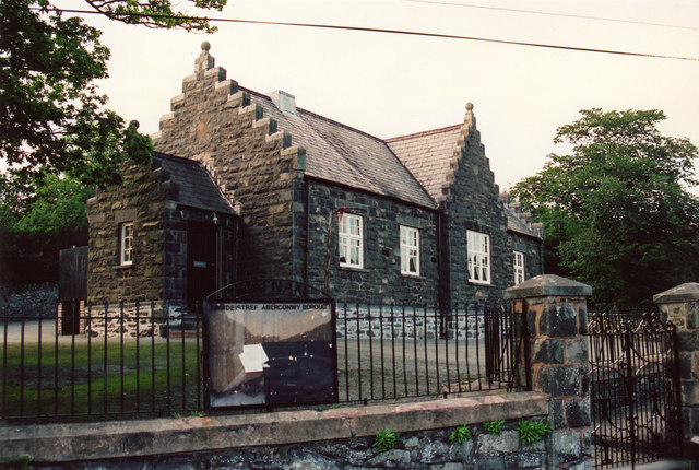
Image: © Carolyn Jones Taken: 29 Aug 1987
Maenan School taken in August 1987 - just after it had been closed
Images are licensed for reuse under creativecommons.org/licenses/by-sa/2.0
Image Location


Leaflet Map data © OpenStreetMap
Latitude
53.18191
Longitude
-3.804624