The Newmill Bridge near Moira
Introduction
The photograph on this page of The Newmill Bridge near Moira by Albert Bridge as part of the Geograph project.
The Geograph project started in 2005 with the aim of publishing, organising and preserving representative images for every square kilometre of Great Britain, Ireland and the Isle of Man.

There are currently over 7.5m images from over 14,400 individuals and you can help contribute to the project by visiting https://www.geograph.org.uk
The Newmill Bridge near Moira
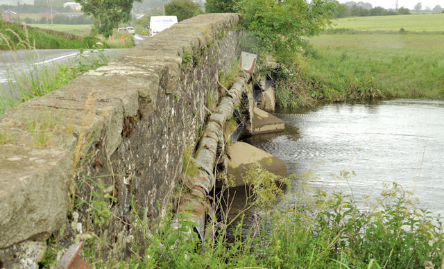
Image: © Albert Bridge Taken: 30 Jun 2012
A three-arch stone bridge, with concrete-reinforced piers, carrying the Clarehill Road across the River Lagan. Built circa 1740/59. Listed and more information is available here http://www.doeni.gov.uk/niea/built/buildview?id=3248&js=true. Last seen in January 2006 Image
Images are licensed for reuse under creativecommons.org/licenses/by-sa/2.0
Image Location
Latitude
54.474053
Longitude
-6.205825