View of Rosefield Mills from Dock Park
Introduction
The photograph on this page of View of Rosefield Mills from Dock Park by Rose and Trev Clough as part of the Geograph project.
The Geograph project started in 2005 with the aim of publishing, organising and preserving representative images for every square kilometre of Great Britain, Ireland and the Isle of Man.

There are currently over 7.5m images from over 14,400 individuals and you can help contribute to the project by visiting https://www.geograph.org.uk
View of Rosefield Mills from Dock Park
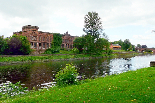
Image: © Rose and Trev Clough Taken: 9 Jun 2012
This imposing building beside the River Nith was part of a large tweed mill, in 1906 over 700 people were employed here (history of tweed manufacturing in Nithsdale - see Future Museum http://futuremuseum.co.uk/collections/life-work/key-industries/textiles/tweed-manufacturing-in-nithsdale.aspx ). Production changed to military cloth during the First World War, after which the company failed to compete in the new markets and did not survive the Depression (see Dumfries Museum http://www.dumfriesmuseum.demon.co.uk/dumfstory06.html ). The site passed into multiple occupation, the main building has been deteriorating over a number of years and appears to be unoccupied - see Image . Aerial photos showing the extent of the mill in 1928 can be seen on Canmore http://canmore.rcahms.gov.uk/en/site/68566/details/dumfries+troqueer+road+rosefield+mills/
Images are licensed for reuse under creativecommons.org/licenses/by-sa/2.0
Image Location
Latitude
55.062967
Longitude
-3.60893