Guide Lane Methodist Church
Introduction
The photograph on this page of Guide Lane Methodist Church by Gerald England as part of the Geograph project.
The Geograph project started in 2005 with the aim of publishing, organising and preserving representative images for every square kilometre of Great Britain, Ireland and the Isle of Man.

There are currently over 7.5m images from over 14,400 individuals and you can help contribute to the project by visiting https://www.geograph.org.uk
Guide Lane Methodist Church
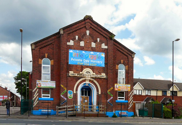
Image: © Gerald England Taken: 19 Jun 2012
The Wesley Methodist Society was formed in Hooley Hill in 1786 by a dissident group of members from the Red Hall Methodist Church, Audenshaw. In 1806 a new purpose built Chapel and Sunday School was built. A large cottage adjacent to the Chapel was converted for school use with the girls taught upstairs and the boys downstairs. A new school building was added in 1855. This building was then replaced in 1901 by the two-storey school which was in use until 1950. The buildings on Guide Lane were closed in 2004. The fellowship joined with Bridge Street United Reformed Church Image Image and Red Hall Methodist Church Image to form Trinity Church Image on Audenshaw Road, Audenshaw. Read the account of Hooley Hill (Wesleyans) Methodist Church 1796 -2004 by Ralph Smethurst former Steward of the Church http://web.archive.org/web/20080723165127/http://www.audenshawlocalhistory.org/page42a.html The building is now the home of the Little Giggles Private Day Nursery. http://www.littlegigglesnursery.co.uk/
Images are licensed for reuse under creativecommons.org/licenses/by-sa/2.0
Image Location
Latitude
53.468604
Longitude
-2.112941