
Centre of the Quartermile Development
Introduction
The photograph on this page of Centre of the Quartermile Development by kim traynor as part of the Geograph project.
The Geograph project started in 2005 with the aim of publishing, organising and preserving representative images for every square kilometre of Great Britain, Ireland and the Isle of Man.

There are currently over 7.5m images from over 14,400 individuals and you can help contribute to the project by visiting https://www.geograph.org.uk
Centre of the Quartermile Development
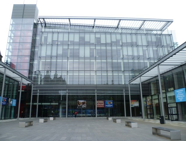
Image: © kim traynor Taken: 11 Jun 2012
This dazzling block forms the central focus of the new Quartermile development. I think it could do with a few sculptures or a fountain to avoid the impression that it's barely distinguishable from a new town shopping precinct. I've had to hazard a guess as to its precise location because the OS mapmakers have not yet caught up with the radical changes to this area.
Images are licensed for reuse under creativecommons.org/licenses/by-sa/2.0
Image Location

Latitude
55.943813
Longitude
-3.192608