Templepatrick Masonic Hall
Introduction
The photograph on this page of Templepatrick Masonic Hall by Albert Bridge as part of the Geograph project.
The Geograph project started in 2005 with the aim of publishing, organising and preserving representative images for every square kilometre of Great Britain, Ireland and the Isle of Man.

There are currently over 7.5m images from over 14,400 individuals and you can help contribute to the project by visiting https://www.geograph.org.uk
Templepatrick Masonic Hall
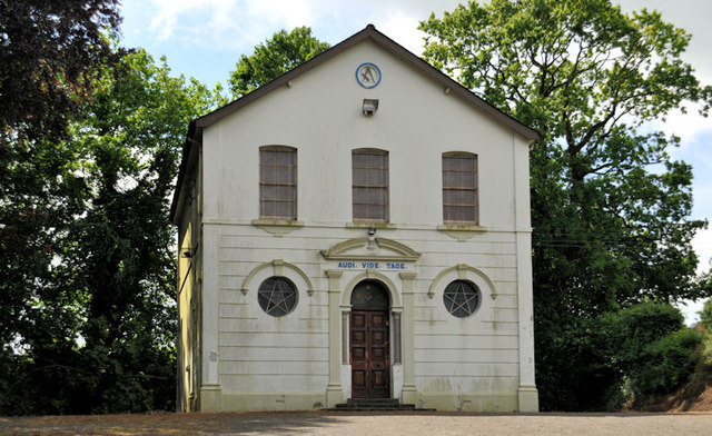
Image: © Albert Bridge Taken: 24 Jun 2012
A hall on the Antrim Road. Not listed but of the list of historic buildings where the date of construction is given as circa 1920. District of the Six Mile Valley, St Paul’s Lodge no 160. Previously seen in Image (November 2005).
Images are licensed for reuse under creativecommons.org/licenses/by-sa/2.0
Image Location
Latitude
54.702062
Longitude
-6.0985