Holy Well Walk information board, Wattons Lane
Introduction
The photograph on this page of Holy Well Walk information board, Wattons Lane by John Brightley as part of the Geograph project.
The Geograph project started in 2005 with the aim of publishing, organising and preserving representative images for every square kilometre of Great Britain, Ireland and the Isle of Man.

There are currently over 7.5m images from over 14,400 individuals and you can help contribute to the project by visiting https://www.geograph.org.uk
Holy Well Walk information board, Wattons Lane
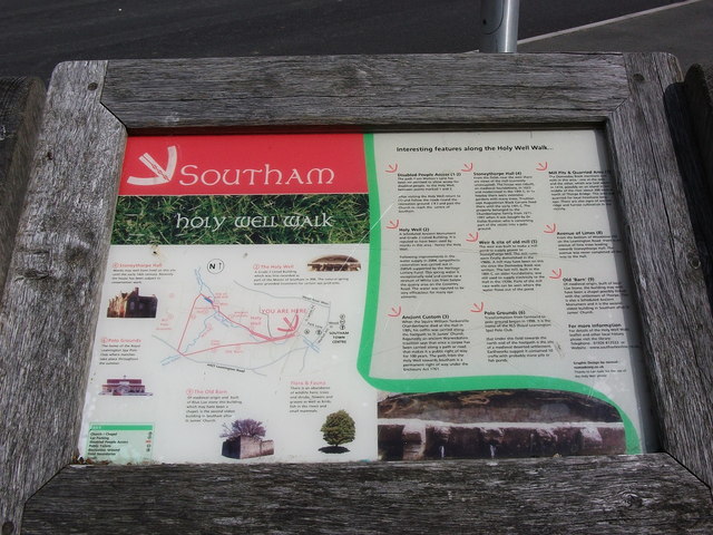
Image: © John Brightley Taken: 23 Jun 2012
The Holy Well Walk was created in 2005-07 by Vision4Southam as part of a wider programme of improvements including the restoration of the well itself. Structures around the trail, including 3 of these interpretative boards, were created by the artist Will Glanfield. http://www.willglanfield.co.uk/
Images are licensed for reuse under creativecommons.org/licenses/by-sa/2.0
Image Location
Latitude
52.252544
Longitude
-1.392911