Road and rail
Introduction
The photograph on this page of Road and rail by Jonathan Billinger as part of the Geograph project.
The Geograph project started in 2005 with the aim of publishing, organising and preserving representative images for every square kilometre of Great Britain, Ireland and the Isle of Man.

There are currently over 7.5m images from over 14,400 individuals and you can help contribute to the project by visiting https://www.geograph.org.uk
Road and rail
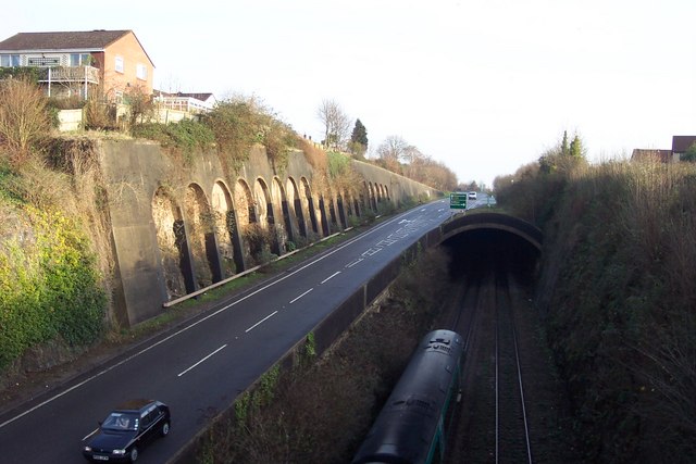
Image: © Jonathan Billinger Taken: 28 Dec 2006
Sharing the same cutting. The newer A48 Tuthill bypass is built partially over the railway line in order to fit it into the same cutting. A northbound train can just be seen.
Images are licensed for reuse under creativecommons.org/licenses/by-sa/2.0
Image Location
Latitude
51.644714
Longitude
-2.664746