Inscription on the loop-holed wall in Seamer
Introduction
The photograph on this page of Inscription on the loop-holed wall in Seamer by John S Turner as part of the Geograph project.
The Geograph project started in 2005 with the aim of publishing, organising and preserving representative images for every square kilometre of Great Britain, Ireland and the Isle of Man.

There are currently over 7.5m images from over 14,400 individuals and you can help contribute to the project by visiting https://www.geograph.org.uk
Inscription on the loop-holed wall in Seamer
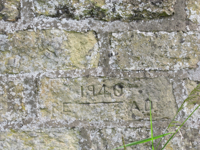
Image: © John S Turner Taken: 20 Jun 2012
The Seamer loop-holed wall is in Main Street, outside the Old Vicarage, and opposite St Martin's church. The wall is a rare survivor of Home Guard defences from the time of the Second World War, and the inscription dates it to '1940'. I don't know what the initials mean, but 'R.E.' could be Royal Engineers, and 'A.D.' may simply be Anno Domini for the year.
Images are licensed for reuse under creativecommons.org/licenses/by-sa/2.0
Image Location
Latitude
54.235881
Longitude
-0.443454