Cottages and churchyard, Chagford
Introduction
The photograph on this page of Cottages and churchyard, Chagford by Derek Harper as part of the Geograph project.
The Geograph project started in 2005 with the aim of publishing, organising and preserving representative images for every square kilometre of Great Britain, Ireland and the Isle of Man.

There are currently over 7.5m images from over 14,400 individuals and you can help contribute to the project by visiting https://www.geograph.org.uk
Cottages and churchyard, Chagford
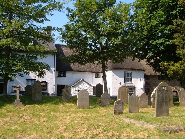
Image: © Derek Harper Taken: 8 Jun 2006
Taken from close to the church, looking across the graveyard to listed houses on the High Street. Jutting out on the right is Whiddon's coffee shop http://list.english-heritage.org.uk/resultsingle.aspx?uid=1326038&searchtype=mapsearch ; in the centre are Church Stile Cottage http://list.english-heritage.org.uk/resultsingle.aspx?uid=1106178&searchtype=mapsearch , a property that once included the coffee shop, and number 5 http://list.english-heritage.org.uk/resultsingle.aspx?uid=1147112&searchtype=mapsearch . To the left is part of the Globe Inn.
Images are licensed for reuse under creativecommons.org/licenses/by-sa/2.0
Image Location
Latitude
50.672449
Longitude
-3.839687