Factory Cross
Introduction
The photograph on this page of Factory Cross by Derek Harper as part of the Geograph project.
The Geograph project started in 2005 with the aim of publishing, organising and preserving representative images for every square kilometre of Great Britain, Ireland and the Isle of Man.

There are currently over 7.5m images from over 14,400 individuals and you can help contribute to the project by visiting https://www.geograph.org.uk
Factory Cross
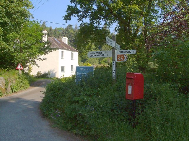
Image: © Derek Harper Taken: 8 Jun 2006
Reducing contrast to show the postbox and signpost at this crossroads south of Chagford Bridge, but the white house (Corner Cottage) behind is still blinding in the morning sun. The trees on the left have now been cleared, revealing the ruins of a mill - see Image The Two Moors Way runs past the junction.
Images are licensed for reuse under creativecommons.org/licenses/by-sa/2.0
Image Location
Latitude
50.67535
Longitude
-3.849566