Peckham Rye station
Introduction
The photograph on this page of Peckham Rye station by Dr Neil Clifton as part of the Geograph project.
The Geograph project started in 2005 with the aim of publishing, organising and preserving representative images for every square kilometre of Great Britain, Ireland and the Isle of Man.

There are currently over 7.5m images from over 14,400 individuals and you can help contribute to the project by visiting https://www.geograph.org.uk
Peckham Rye station
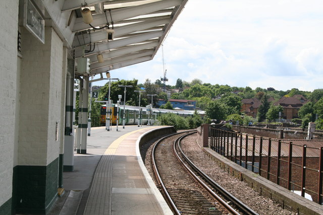
Image: © Dr Neil Clifton Taken: 18 Jun 2012
Peckham Rye is an unusual station, being really two separate stations, since 1923 combined into one. The more northerly pair of platforms, now 3 and 4, lie on the ex-LCD line from Victoria which (originally) ran to Crystal Palace (High Level) and Greenwich Park. At the eastern end, both these lines have been closed and now the line goes to Lewisham. The southerly part of the station (platforms 1 and 2) is an island platform, (originally this part had side platforms as well) on the ex-LBSC South London line. This photograph is taken on the South London side looking westwards with a Class 455 unit just having departed on its way to Victoria.
Images are licensed for reuse under creativecommons.org/licenses/by-sa/2.0
Image Location
Latitude
51.469418
Longitude
-0.070304