View of Manston Airport from the Allied Air Forces Memorial Garden
Introduction
The photograph on this page of View of Manston Airport from the Allied Air Forces Memorial Garden by Marathon as part of the Geograph project.
The Geograph project started in 2005 with the aim of publishing, organising and preserving representative images for every square kilometre of Great Britain, Ireland and the Isle of Man.

There are currently over 7.5m images from over 14,400 individuals and you can help contribute to the project by visiting https://www.geograph.org.uk
View of Manston Airport from the Allied Air Forces Memorial Garden
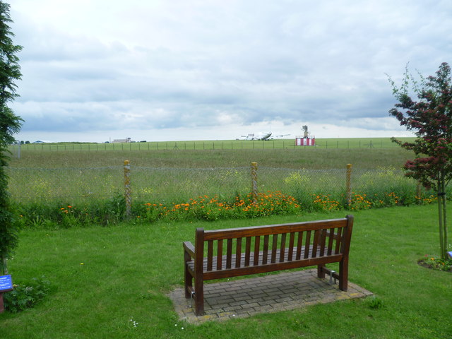
Image: © Marathon Taken: 18 Jun 2012
This is the view from the Allied Air Forces Memorial Garden next to the Spitfire & Hurricane Memorial Building at Manston. It is looking across Manston Airport, or more properly Manston - Kent's International Airport. Manston Airport is a strange place and there seem to be a number of obsolete aircraft stranded around the site. One of them can be glimpsed here, just to the left of the red and white striped structure.
Images are licensed for reuse under creativecommons.org/licenses/by-sa/2.0
Image Location
Latitude
51.348577
Longitude
1.349042