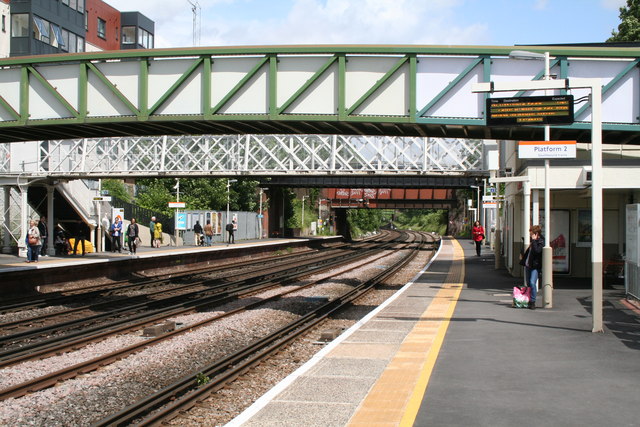
Brockley Station
Introduction
The photograph on this page of Brockley Station by Dr Neil Clifton as part of the Geograph project.
The Geograph project started in 2005 with the aim of publishing, organising and preserving representative images for every square kilometre of Great Britain, Ireland and the Isle of Man.
There are currently over 7.5m images from over 14,400 individuals and you can help contribute to the project by visiting https://www.geograph.org.uk

Image: © Dr Neil Clifton Taken: 15 Jun 2012
Looking north at Brockley Station we see a profusion of overbridges. Nearest to the camera and painted green and white is a public footbridge, which can be used by anyone, as it is wholly outside the station barriers. Then comes the white-painted station bridge which is within the barriers, so use of this bridge is restricted to persons in possession of a railway ticket or pass. Next after this, with only its black-painted lower edge visible, is a bridge carrying the ex-LCD railway line, now between Nunhead and Lewisham. There was at one time a station, called Brockley Lane, on this line somewhat to the east, but it closed many years ago. After this is a road bridge a rusty red-brown with graffiti. A considerable distance beyond is another road bridge painted pale green. It carries Vista Road, but no motor traffic is allowed over it.

