View of the railway lines into and out of Farringdon station from Ray Street bridge
Introduction
The photograph on this page of View of the railway lines into and out of Farringdon station from Ray Street bridge by Robert Lamb as part of the Geograph project.
The Geograph project started in 2005 with the aim of publishing, organising and preserving representative images for every square kilometre of Great Britain, Ireland and the Isle of Man.

There are currently over 7.5m images from over 14,400 individuals and you can help contribute to the project by visiting https://www.geograph.org.uk
View of the railway lines into and out of Farringdon station from Ray Street bridge
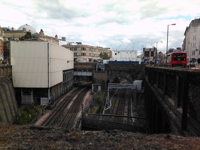
Image: © Robert Lamb Taken: 18 Jun 2012
I had to take this photo over a high wall, hence why you can see the top of the wall at the bottom of the image. The tracks to the left carry the London Underground Circle, Hammersmith and City and Metropolitan lines, while the tracks on the right carry Thameslink services to destinations such as Brighton, Bedford, etc. Looking south-southeast.
Images are licensed for reuse under creativecommons.org/licenses/by-sa/2.0
Image Location
Latitude
51.522445
Longitude
-0.107128