Crumlin station (2012)
Introduction
The photograph on this page of Crumlin station (2012) by Albert Bridge as part of the Geograph project.
The Geograph project started in 2005 with the aim of publishing, organising and preserving representative images for every square kilometre of Great Britain, Ireland and the Isle of Man.

There are currently over 7.5m images from over 14,400 individuals and you can help contribute to the project by visiting https://www.geograph.org.uk
Crumlin station (2012)
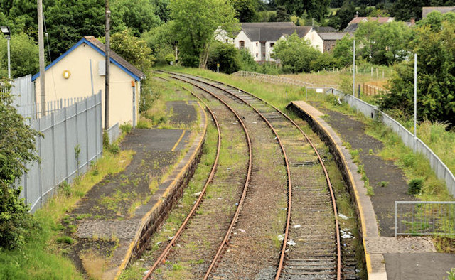
Image: © Albert Bridge Taken: 17 Jun 2012
The “mothballed” Crumlin station, looking towards Antrim, from the overbridge at the eastern end of Main Street. Now a bit forlorn and in need of spraying to keep the weeds under control. This one shows the station in June 1974, not long after it had re-opened to passenger trains Image For comparison see Image after remedial work to retain the line in a safe running order.
Images are licensed for reuse under creativecommons.org/licenses/by-sa/2.0
Image Location
Latitude
54.62059
Longitude
-6.211767