Former police station, Crumlin
Introduction
The photograph on this page of Former police station, Crumlin by Albert Bridge as part of the Geograph project.
The Geograph project started in 2005 with the aim of publishing, organising and preserving representative images for every square kilometre of Great Britain, Ireland and the Isle of Man.

There are currently over 7.5m images from over 14,400 individuals and you can help contribute to the project by visiting https://www.geograph.org.uk
Former police station, Crumlin
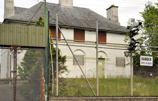
Image: © Albert Bridge Taken: 17 Jun 2012
The closed police station on the Mill Road. One of a series built, to a standard design (which included living accommodation) by TPO Rippingham, the Chief Architect at the Ministry of Finance, in the 1920’s/30’s. Many were closed and sold in the 1960’s. Some such examples may be found at Loughbrickland, Poyntzpass, Dundrum and Seaforde. Image shows a similar one in Templepatrick. Continue to Image
Images are licensed for reuse under creativecommons.org/licenses/by-sa/2.0
Image Location
Latitude
54.62216
Longitude
-6.21464