Millwall: Docklands Light Railway, Mudchute station
Introduction
The photograph on this page of Millwall: Docklands Light Railway, Mudchute station by Dr Neil Clifton as part of the Geograph project.
The Geograph project started in 2005 with the aim of publishing, organising and preserving representative images for every square kilometre of Great Britain, Ireland and the Isle of Man.

There are currently over 7.5m images from over 14,400 individuals and you can help contribute to the project by visiting https://www.geograph.org.uk
Millwall: Docklands Light Railway, Mudchute station
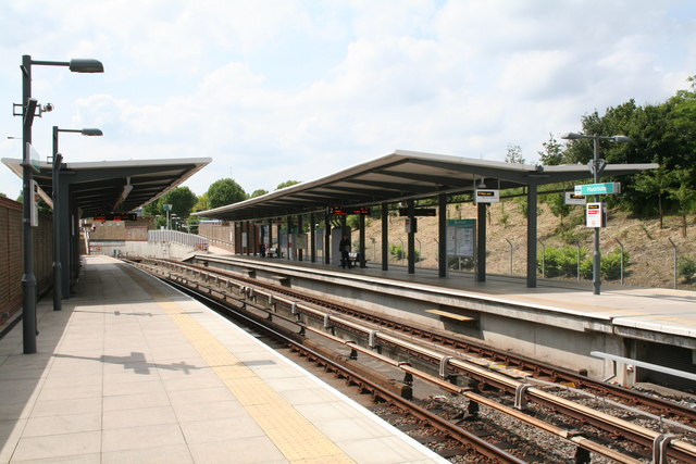
Image: © Dr Neil Clifton Taken: 14 Jun 2012
Looking north. This is not the first Mudchute DLR station: that opened with the railway in 1983, and was slightly further east and on a higher level. But in 1999 when the Lewisham extension was being constructed, it was necessary for the DLR to run under the River Thames, necessitating the closure and demolition of the high-level Island Gardens station and its replacement by an underground station nearby. In order to achieve a reasonable gradient, the descent to the lower lever had to start just north of Mudchute station, so the present station was opened that year.
Images are licensed for reuse under creativecommons.org/licenses/by-sa/2.0
Image Location


Leaflet Map data © OpenStreetMap
Latitude
51.491429
Longitude
-0.015211