Work in progress on lowering the road level, Ty Du railway bridge
Introduction
The photograph on this page of Work in progress on lowering the road level, Ty Du railway bridge by Jaggery as part of the Geograph project.
The Geograph project started in 2005 with the aim of publishing, organising and preserving representative images for every square kilometre of Great Britain, Ireland and the Isle of Man.

There are currently over 7.5m images from over 14,400 individuals and you can help contribute to the project by visiting https://www.geograph.org.uk
Work in progress on lowering the road level, Ty Du railway bridge
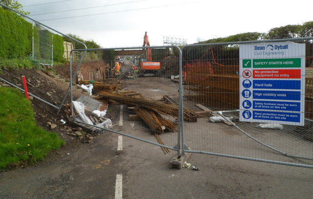
Image: © Jaggery Taken: 19 Apr 2012
Because of the 12' 9" clearance under the railway bridge, high-sided vehicles on the A48 heading for Kenfig Industrial Estate had to take a long detour via North Cornelly, disrupting the lives of many residents of the village. After more than a decade of campaigning by villagers, work is now (April 2012) in progress to increase the headroom by lowering the road surface to allow the passage of high-sided vehicles. As well as improving the lives of North Cornelly residents, Neath Port Talbot County Borough Council hope that the direct access route will attract Bridgend-based businesses back to the industrial estate.
Images are licensed for reuse under creativecommons.org/licenses/by-sa/2.0
Image Location


Leaflet Map data © OpenStreetMap
Latitude
51.538591
Longitude
-3.725885