Nottingham - NG7 (Canning Circus Area)
Introduction
The photograph on this page of Nottingham - NG7 (Canning Circus Area) by David Hallam-Jones as part of the Geograph project.
The Geograph project started in 2005 with the aim of publishing, organising and preserving representative images for every square kilometre of Great Britain, Ireland and the Isle of Man.

There are currently over 7.5m images from over 14,400 individuals and you can help contribute to the project by visiting https://www.geograph.org.uk
Nottingham - NG7 (Canning Circus Area)
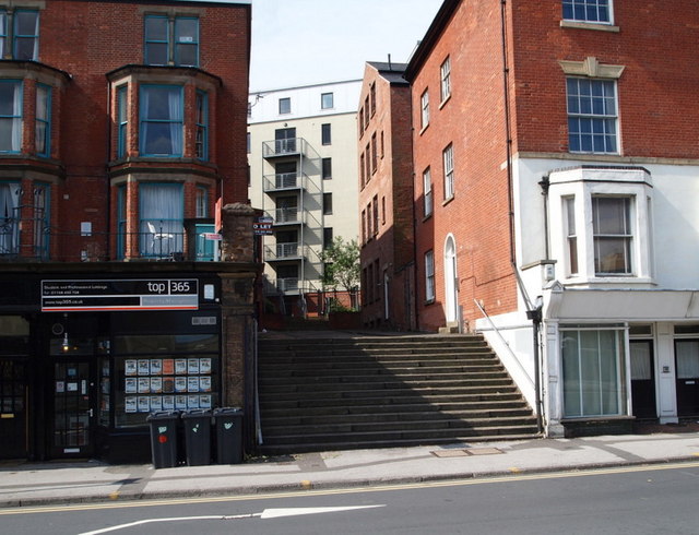
Image: © David Hallam-Jones Taken: 10 Jun 2012
An extremely faded inscription on the brickwork of the house on the right - between the two metal brackets securing the drainpipe to the wall - declares this to be "Park Hill". It seems likely that in the path this set of steps, plus a short path or passageway, connected Derby Road (seen at the foot of these steps) with Ilkeston Road. In the distance there is gated access to a modern block of apartments that are currently being used by students. Unfortunately pedestrians are obliged to pass through the rather insalubrious, raised forecourt that exists between the two older houses.
Images are licensed for reuse under creativecommons.org/licenses/by-sa/2.0
Image Location
Latitude
52.955332
Longitude
-1.163858