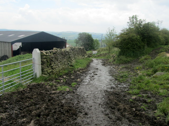
Track descending towards Flass Bent
Introduction
The photograph on this page of Track descending towards Flass Bent by Chris Heaton as part of the Geograph project.
The Geograph project started in 2005 with the aim of publishing, organising and preserving representative images for every square kilometre of Great Britain, Ireland and the Isle of Man.
There are currently over 7.5m images from over 14,400 individuals and you can help contribute to the project by visiting https://www.geograph.org.uk

Image: © Chris Heaton Taken: 13 Jun 2012
In days of yore, landowners of a certain station would construct tunnels or deep cuttings in order that their eyes were not offended by the general public walking by their premises. In more modern times gates, barbed wire, padlocks are sometimes placed across the walkers path to prevent further progress. The occupants of Flass Bent have come with a more novel method of barring ramblers from their immediate property. Cover the surface of the right of way with a thick layer of slurry and sloppy manure. Timid walkers will give up at first sight of this earthy barrier. The more determined rambler will find further progress comes to a halt as the mixture underfoot slops over the top of the boot and fills the cavity between sock and insole with noxious evil mud - it is much deeper than it looks. This leaves the come hell or high water rambler who has come equipped with bogtrotters. He will find as he lifts his feet out of the slurry, he will disturb a stench of such magnitude that he will be forced to turn tail and flee the scene immediately. Thus the occupants of Flass Bent can continue life in the sure knowledge that their peace will remain undisturbed.

