Quay Street, Ammanford (Recreated)
Introduction
The photograph on this page of Quay Street, Ammanford (Recreated) by Nigel Davies as part of the Geograph project.
The Geograph project started in 2005 with the aim of publishing, organising and preserving representative images for every square kilometre of Great Britain, Ireland and the Isle of Man.

There are currently over 7.5m images from over 14,400 individuals and you can help contribute to the project by visiting https://www.geograph.org.uk
Quay Street, Ammanford (Recreated)
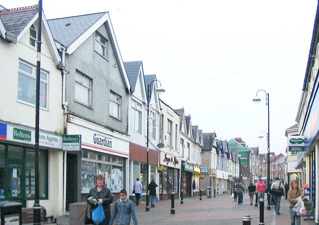
Image: © Nigel Davies Taken: 24 Dec 2006
Another shot of Quay Street recreated from the Frith collection. This time it is a 1936 shot ( http://www.francisfrith.com/search/wales/dyfed/ammanford/photos/ammanford_87811.htm ) of the west side of the street running from south of where Hall Street joins it, up to the town square. The roof line is much the same in both shots, but the modern buildings have lost all their bay windows and awnings.
Images are licensed for reuse under creativecommons.org/licenses/by-sa/2.0
Image Location


Leaflet Map data © OpenStreetMap
Latitude
51.791722
Longitude
-3.987556