Ammanford Park (Recreated)
Introduction
The photograph on this page of Ammanford Park (Recreated) by Nigel Davies as part of the Geograph project.
The Geograph project started in 2005 with the aim of publishing, organising and preserving representative images for every square kilometre of Great Britain, Ireland and the Isle of Man.

There are currently over 7.5m images from over 14,400 individuals and you can help contribute to the project by visiting https://www.geograph.org.uk
Ammanford Park (Recreated)
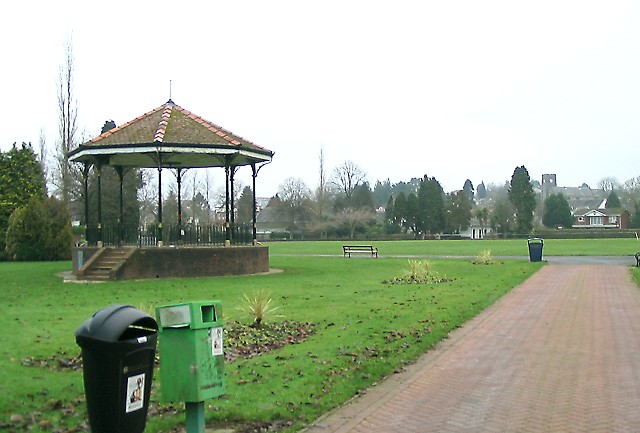
Image: © Nigel Davies Taken: 24 Dec 2006
A view of the bandstand and cricket pitch taken from the entrance on Tir-y-dail Lane. On the horizon beyond the end of the path, All Saints Church can be seen on the hill. Apart from the trees on the back line of the shot, and the bins in the foreground, little has changed since the 1965 photo from the Frith collection: http://www.francisfrith.com/search/wales/dyfed/ammanford/photos/ammanford_A186088.htm
Images are licensed for reuse under creativecommons.org/licenses/by-sa/2.0
Image Location
Latitude
51.792453
Longitude
-3.992229