Calf Lane level crossing, Coleraine (1)
Introduction
The photograph on this page of Calf Lane level crossing, Coleraine (1) by Albert Bridge as part of the Geograph project.
The Geograph project started in 2005 with the aim of publishing, organising and preserving representative images for every square kilometre of Great Britain, Ireland and the Isle of Man.

There are currently over 7.5m images from over 14,400 individuals and you can help contribute to the project by visiting https://www.geograph.org.uk
Calf Lane level crossing, Coleraine (1)
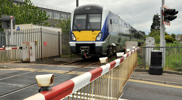
Image: © Albert Bridge Taken: 13 Jun 2012
See Image (November 2006). C4K set 4008 approaching Calf Lane level crossing, on the Artillery Road, with the 13.15 Coleraine – Portrush.
Images are licensed for reuse under creativecommons.org/licenses/by-sa/2.0
Image Location
Latitude
55.137956
Longitude
-6.664799