Grade II listed Cambrian House, Newport
Introduction
The photograph on this page of Grade II listed Cambrian House, Newport by Jaggery as part of the Geograph project.
The Geograph project started in 2005 with the aim of publishing, organising and preserving representative images for every square kilometre of Great Britain, Ireland and the Isle of Man.

There are currently over 7.5m images from over 14,400 individuals and you can help contribute to the project by visiting https://www.geograph.org.uk
Grade II listed Cambrian House, Newport
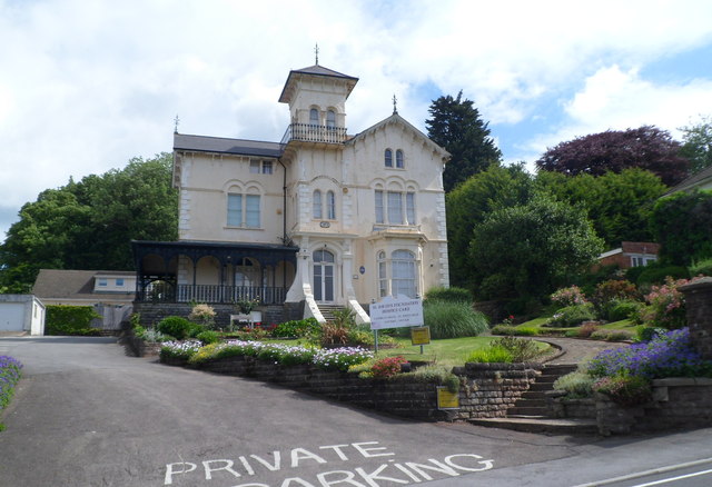
Image: © Jaggery Taken: 9 Jun 2012
Located on the north side of St John's Road, Cambrian House is currently occupied by St David's Foundation Hospice Care. A blue plaque http://www.geograph.org.uk/photo/2986984 on the building records that the building dates from 1854 (though the year 1859 appears on a tablet above the doorway). It was built for Thomas Spittle, who developed the Cambrian foundry on a site later known as Spittle's Point. He also owned works on the east bank (of the River Usk) where three iron ships were launched. Cambrian House was Grade II listed in February 1980.
Images are licensed for reuse under creativecommons.org/licenses/by-sa/2.0
Image Location
Latitude
51.590402
Longitude
-2.974307