Cofton Hall Farm
Introduction
The photograph on this page of Cofton Hall Farm by Derek Harper as part of the Geograph project.
The Geograph project started in 2005 with the aim of publishing, organising and preserving representative images for every square kilometre of Great Britain, Ireland and the Isle of Man.

There are currently over 7.5m images from over 14,400 individuals and you can help contribute to the project by visiting https://www.geograph.org.uk
Cofton Hall Farm
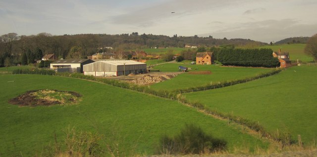
Image: © Derek Harper Taken: 6 Apr 2012
Like Image, this was taken from the main railway line between Longbridge and Barnt Green. The farm and its buildings constitutes a hamlet in its own right. The prominent barn has been added since the version of Google Maps I was using. The farmhouse is behind this barn. Tucked behind are a listed C18 barn, stables and cow house http://list.english-heritage.org.uk/resultsingle.aspx?uid=1100212&searchtype=mapsearch . On the right are two cottages. In the background is the wooded Cofton Hill, part of the Lickey Hills.
Images are licensed for reuse under creativecommons.org/licenses/by-sa/2.0
Image Location
Latitude
52.374571
Longitude
-1.985414