
Sconce and Devon Park
Introduction
The photograph on this page of Sconce and Devon Park by Trevor Rickard as part of the Geograph project.
The Geograph project started in 2005 with the aim of publishing, organising and preserving representative images for every square kilometre of Great Britain, Ireland and the Isle of Man.

There are currently over 7.5m images from over 14,400 individuals and you can help contribute to the project by visiting https://www.geograph.org.uk
Sconce and Devon Park
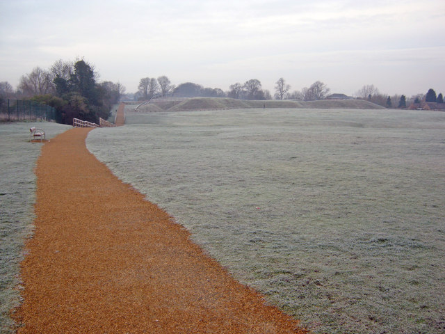
Image: © Trevor Rickard Taken: 29 Jan 2012
Looking south-west along the new perimeter path on a very frosty January morning. The earthwork of the Queen's Sconce is on the far side of this field. The River Devon forms the western boundary of the park, providing the other part of the park name. The sconce is one of the best-preserved earthwork fortifications in Britain. Built in 1644, it played a prominent role in the Royalist defences during the Third Siege of Newark by Parliamentary forces. http://www.newark-sherwooddc.gov.uk/sconceanddevon/
Images are licensed for reuse under creativecommons.org/licenses/by-sa/2.0
Image Location

Latitude
53.07
Longitude
-0.819853