Beck House
Introduction
The photograph on this page of Beck House by Richard Croft as part of the Geograph project.
The Geograph project started in 2005 with the aim of publishing, organising and preserving representative images for every square kilometre of Great Britain, Ireland and the Isle of Man.

There are currently over 7.5m images from over 14,400 individuals and you can help contribute to the project by visiting https://www.geograph.org.uk
Beck House
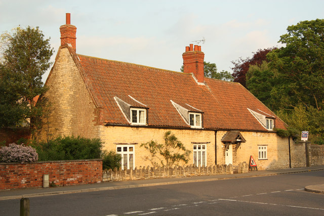
Image: © Richard Croft Taken: 29 May 2012
Grade II listed, 16th century house on The Green, with a steeply pitched pantile roof, thatched until c1900.
Images are licensed for reuse under creativecommons.org/licenses/by-sa/2.0
Image Location
Latitude
53.265731
Longitude
-0.488057