The Bridge Inn
Introduction
The photograph on this page of The Bridge Inn by David Dixon as part of the Geograph project.
The Geograph project started in 2005 with the aim of publishing, organising and preserving representative images for every square kilometre of Great Britain, Ireland and the Isle of Man.

There are currently over 7.5m images from over 14,400 individuals and you can help contribute to the project by visiting https://www.geograph.org.uk
The Bridge Inn
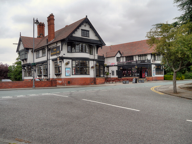
Image: © David Dixon Taken: 5 Jun 2012
The Bridge Inn opened in 1900 as a temperance meeting house. It obtained its licence three years later after a ballot amongst the workers voted for alcohol to be allowed. Originally, there was a bridge here which carried Bolton Road over the tidal arm of Bromborough Pool. Soon after, the creek was dammed and filled in. By 1910, the ground had been raised to road level and the bridge's arch buried from sight beneath the present roadway.
Images are licensed for reuse under creativecommons.org/licenses/by-sa/2.0
Image Location
Latitude
53.351525
Longitude
-2.994627