Open to question, Dinan Way
Introduction
The photograph on this page of Open to question, Dinan Way by Anthony Vosper as part of the Geograph project.
The Geograph project started in 2005 with the aim of publishing, organising and preserving representative images for every square kilometre of Great Britain, Ireland and the Isle of Man.

There are currently over 7.5m images from over 14,400 individuals and you can help contribute to the project by visiting https://www.geograph.org.uk
Open to question, Dinan Way
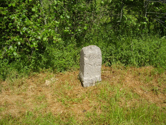
Image: © Anthony Vosper Taken: 6 Jun 2012
This stone dated 1863 whilst slightly damaged contains what appears to be a War Department benchmark. The question is, is it in its original position? Dinan Way is a relatively new road this stone is hidden away behind a crash barrier. Was it moved at some point? The Royal Marine camp is a few miles up the road at Lympston.
Images are licensed for reuse under creativecommons.org/licenses/by-sa/2.0
Image Location
Latitude
50.64465
Longitude
-3.400557