Sheffield - S1 (City Centre)
Introduction
The photograph on this page of Sheffield - S1 (City Centre) by David Hallam-Jones as part of the Geograph project.
The Geograph project started in 2005 with the aim of publishing, organising and preserving representative images for every square kilometre of Great Britain, Ireland and the Isle of Man.
There are currently over 7.5m images from over 14,400 individuals and you can help contribute to the project by visiting https://www.geograph.org.uk

Image: © David Hallam-Jones Taken: 3 Jun 2012
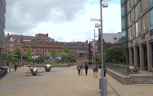
This photograph was taken in Millennium Square looking at another part of the same square. The square forms part of the 'Gold Route' that has been designed to encourage visitors to move through the city centre from the railway station to Devonshire Green. Although referred to as a square it is in fact triangular and is surrounded by new developments on three sides with the redeveloped Peace Gardens on the remaining side (straight ahead). Some of the space on the right-hand side was previously occupied by a modern extension of the Town Hall that was referred to as "The Egg Box" by local people because of its shape. The red brick buildings are situated on Pinstone Street.

