Eglwys Sant Pedr 2
Introduction
The photograph on this page of Eglwys Sant Pedr 2 by Jonathan Wilkins as part of the Geograph project.
The Geograph project started in 2005 with the aim of publishing, organising and preserving representative images for every square kilometre of Great Britain, Ireland and the Isle of Man.

There are currently over 7.5m images from over 14,400 individuals and you can help contribute to the project by visiting https://www.geograph.org.uk
Eglwys Sant Pedr 2
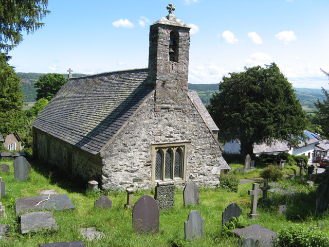
Image: © Jonathan Wilkins Taken: 4 Jun 2012
A view from the top of the burial ground that shows the long nave and bell tower. The elevated position of the church and village on the high flank of the Conwy Valley is also well demonstrated.
Images are licensed for reuse under creativecommons.org/licenses/by-sa/2.0
Image Location
Latitude
53.208611
Longitude
-3.85726