The Forge, Branscombe
Introduction
The photograph on this page of The Forge, Branscombe by Derek Harper as part of the Geograph project.
The Geograph project started in 2005 with the aim of publishing, organising and preserving representative images for every square kilometre of Great Britain, Ireland and the Isle of Man.

There are currently over 7.5m images from over 14,400 individuals and you can help contribute to the project by visiting https://www.geograph.org.uk
The Forge, Branscombe
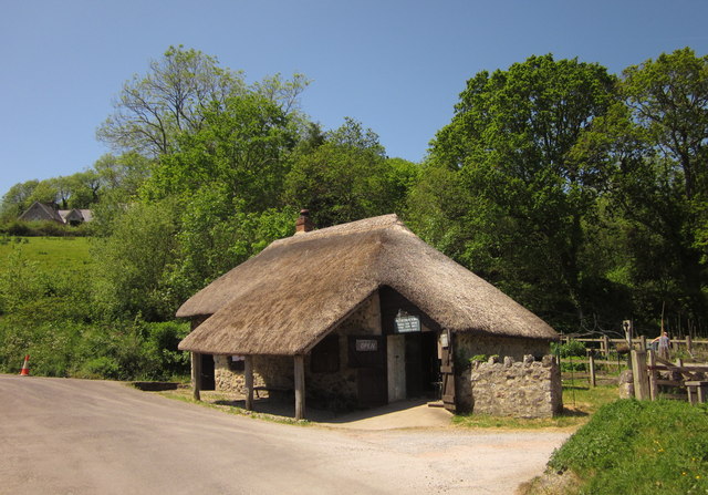
Image: © Derek Harper Taken: 29 May 2012
This thatched smithy (also shown at http://www.geograph.org.uk/search.php?i=31892255 ) dates, according to http://list.english-heritage.org.uk/resultsingle.aspx?uid=1104145&searchtype=mapsearch , from the late C18-early C19, which rather contradicts the date of 1580 given on the forge's website http://branscombe-forge.co.uk/history
Images are licensed for reuse under creativecommons.org/licenses/by-sa/2.0
Image Location
Latitude
50.692296
Longitude
-3.138071