View north from 'The Fortress', Whitehills
Introduction
The photograph on this page of View north from 'The Fortress', Whitehills by Andrew Curtis as part of the Geograph project.
The Geograph project started in 2005 with the aim of publishing, organising and preserving representative images for every square kilometre of Great Britain, Ireland and the Isle of Man.

There are currently over 7.5m images from over 14,400 individuals and you can help contribute to the project by visiting https://www.geograph.org.uk
View north from 'The Fortress', Whitehills
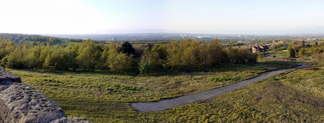
Image: © Andrew Curtis Taken: 20 May 2012
The area on which 'The Fortress' was constructed was once a slag heap for Heworth Colliery to the south-east of Windy Nook quarry. It had a connection to the Pelaw Main Waggonway providing access to the Pelaw Main coal staithes on the River Tyne at Bill Quay. The colliery closed in 1963.
Images are licensed for reuse under creativecommons.org/licenses/by-sa/2.0
Image Location
Latitude
54.936153
Longitude
-1.567798