Sheffield - S10 (Lodge Moor)
Introduction
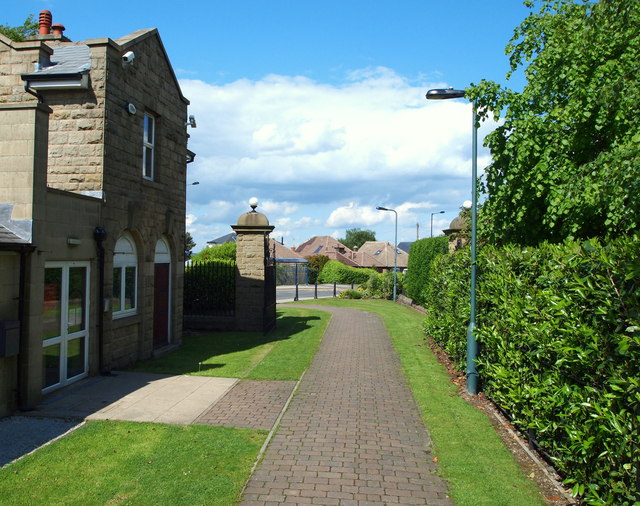
The photograph on this page of Sheffield - S10 (Lodge Moor) by David Hallam-Jones as part of the Geograph project.
The Geograph project started in 2005 with the aim of publishing, organising and preserving representative images for every square kilometre of Great Britain, Ireland and the Isle of Man.
There are currently over 7.5m images from over 14,400 individuals and you can help contribute to the project by visiting https://www.geograph.org.uk

Image: © David Hallam-Jones Taken: 4 Jun 2012
The view out of the main gates and entrance of the former Lodge Moor Hospital (now pedestrianised) onto Redmires Road. How many people must have passed through these gates during the hospital's life as a smallpox isolation hospital, then as a traditional infectious diseases hospital and finally when it was a general hospital and Regional Spinal Injuries Unit? Hundreds of thousands perhaps if one includes patients, visitors and staff. This site sits at an altitude of 280 metres (919 ft) above sea level and as such is one of the first locations in Sheffield to suffer the effects of snow falls.

