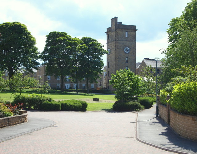
Sheffield - S10 (Lodge Moor)
Introduction
The photograph on this page of Sheffield - S10 (Lodge Moor) by David Hallam-Jones as part of the Geograph project.
The Geograph project started in 2005 with the aim of publishing, organising and preserving representative images for every square kilometre of Great Britain, Ireland and the Isle of Man.
There are currently over 7.5m images from over 14,400 individuals and you can help contribute to the project by visiting https://www.geograph.org.uk

Image: © David Hallam-Jones Taken: 4 Jun 2012
The water tower of the former Lodge Moor Hospital as seen from near the former main entrance. (Most former employers tended to refer to the tower as “The Clock Tower” because of its clocks, although its primary function was to store water for the hospital). The tower itself was not built until 1905. The whole site is now an up-market housing estate and is still (!) situated at an altitude of 280 metres (919 ft) above sea level. In addition, the tower - that now houses several apartments - is approximately 25 metres (75 ft) taller, making it visible from up to 4-5 miles away. The hospital was established in response to the smallpox epidemic in Sheffield (1887-88) and was soon developed to treat other infectious diseases too. Eventually medical, surgical and spinal injuries patients were also cared for here and the Sheffield School of Nursing also had an education centre on site.

