Sheffield - S11 (Fulwood)
Introduction
The photograph on this page of Sheffield - S11 (Fulwood) by David Hallam-Jones as part of the Geograph project.
The Geograph project started in 2005 with the aim of publishing, organising and preserving representative images for every square kilometre of Great Britain, Ireland and the Isle of Man.
There are currently over 7.5m images from over 14,400 individuals and you can help contribute to the project by visiting https://www.geograph.org.uk

Image: © David Hallam-Jones Taken: 4 Jun 2012
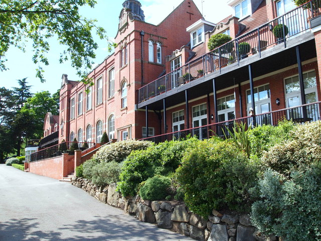
An uphill view along Woofindin Road (now renamed Woofindin Avenue) that leads to Fulwood village. Woofindin Road once connected Hangingwater Road, Nether Green (3-4 mins walk behind the photographer) with Fulwood Rd. It was a private road that was occasionally secured with a chain & padlock to maintain its status. This Edwardian building, which was converted into expensive apartments during the early C21st, overlooks part of the Mayfield Valley. The property was originally built in 1901 as a 65 bedded convalescent home, courtesy of a legacy in the will of George Woofindin, a retired manufacturer of Sharrow. During WWI it was served as the "Woodfindin Home Auxiliary Hospital (Class B) with 62 beds. Still later in its life it served as a rehabilitation centre for miners. During WWII it functioned as an annexe of The Royal Infirmary. In 1958 it was converted into the Whiteley Wood Psychiatric Clinic (with beds for 13 men and 16 women); services for day & out patients being developed later). There is no longer a through road to Fulwood Road (ahead) because the top end of the road was closed off and expanded sometime ago in order to extend an existing NHS Trust office-block car park, formerly that of the Trent Regional Health Authority HQ.

