Nottingham - NG11 (Wilford Village Area)
Introduction
The photograph on this page of Nottingham - NG11 (Wilford Village Area) by David Hallam-Jones as part of the Geograph project.
The Geograph project started in 2005 with the aim of publishing, organising and preserving representative images for every square kilometre of Great Britain, Ireland and the Isle of Man.

There are currently over 7.5m images from over 14,400 individuals and you can help contribute to the project by visiting https://www.geograph.org.uk
Nottingham - NG11 (Wilford Village Area)
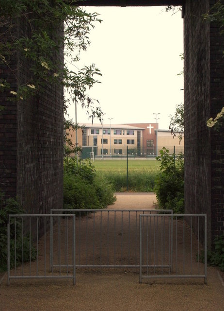
Image: © David Hallam-Jones Taken: 2 Jun 2012
A view of the footpath and cycle track that passes beneath a bridge that once carried Great Central Railway (GCR) trains overhead. Presumably this path and cycle track provide easy access between Wilford Village and The Nottingham Emmanuel School (seen in the distance). This 50ft (15m) high embankment forms part of the boundary between Rushcliffe and Nottingham. The railway opened in 1899 and ran from Sheffield to London via Annesley, Nottingham (Victoria), Loughborough Central, Leicester Central, Lutterworth, Rugby and Woodford Halse. Most of the route was closed between 1966-69 as part of the Beeching rationalisation plan.
Images are licensed for reuse under creativecommons.org/licenses/by-sa/2.0
Image Location
Latitude
52.932524
Longitude
-1.154628