Harmer Street , Gravesend
Introduction
The photograph on this page of Harmer Street , Gravesend by Richard Rogerson as part of the Geograph project.
The Geograph project started in 2005 with the aim of publishing, organising and preserving representative images for every square kilometre of Great Britain, Ireland and the Isle of Man.

There are currently over 7.5m images from over 14,400 individuals and you can help contribute to the project by visiting https://www.geograph.org.uk
Harmer Street , Gravesend
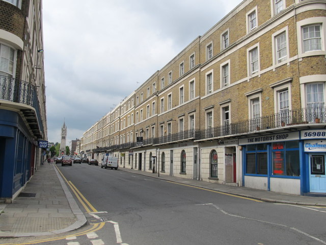
Image: © Richard Rogerson Taken: 1 Jun 2012
Harmer Street was built in 1836 as part of an elaborate and grand scheme by the Milton Park Estate, whose chairman was Alderman Harmer. It was attributed to the Brighton Architect Amon Henry Wilds. The street consists of two continuous brick-built terraces comprising pairs of buildings which step up to accommodate the slope of the land.
Images are licensed for reuse under creativecommons.org/licenses/by-sa/2.0
Image Location
Latitude
51.442563
Longitude
0.373657