Overlooking Pontywaun
Introduction
The photograph on this page of Overlooking Pontywaun by Robin Drayton as part of the Geograph project.
The Geograph project started in 2005 with the aim of publishing, organising and preserving representative images for every square kilometre of Great Britain, Ireland and the Isle of Man.

There are currently over 7.5m images from over 14,400 individuals and you can help contribute to the project by visiting https://www.geograph.org.uk
Overlooking Pontywaun
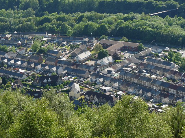
Image: © Robin Drayton Taken: 28 May 2012
Taken from car park 4 at “Windy Ridge” of the Cwmcarn Forest Drive. The disused viaduct at the top right crosses the A467 and the River Ebbw. This was originally the route of Hall's Tramway and later a railway. For a view from the other side of the Ebbw Valley see http://www.geograph.org.uk/photo/128003 .
Images are licensed for reuse under creativecommons.org/licenses/by-sa/2.0
Image Location
Latitude
51.631026
Longitude
-3.127028