Overlooking Cwmcarn
Introduction
The photograph on this page of Overlooking Cwmcarn by Robin Drayton as part of the Geograph project.
The Geograph project started in 2005 with the aim of publishing, organising and preserving representative images for every square kilometre of Great Britain, Ireland and the Isle of Man.

There are currently over 7.5m images from over 14,400 individuals and you can help contribute to the project by visiting https://www.geograph.org.uk
Overlooking Cwmcarn
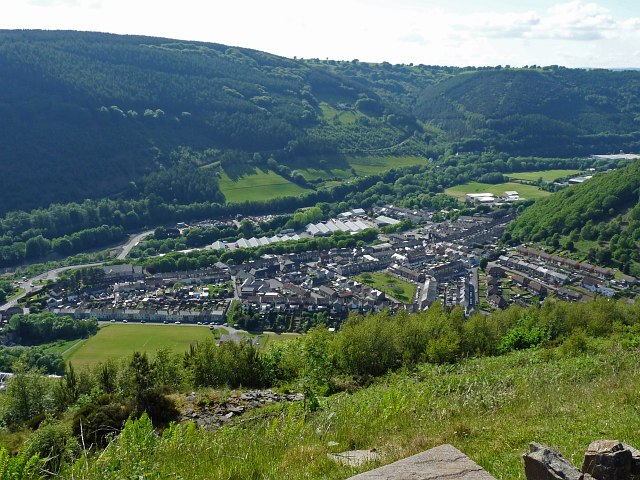
Image: © Robin Drayton Taken: 28 May 2012
Taken from car park 4 at “Windy Ridge” of the Cwmcarn Forest Drive. The Ebbw Valley runs from centre left to upper right with the Carn Valley off to the centre right. Originally, the village here at the confluence of the Carn brook with the River Ebbw was Abercarn. However, as industry developed further north up the Ebbw Valley that area became what is now Abercarn and the village here took the name Cwmcarn.
Images are licensed for reuse under creativecommons.org/licenses/by-sa/2.0
Image Location
Latitude
51.634619
Longitude
-3.127406