Quay House, Reydon
Introduction
The photograph on this page of Quay House, Reydon by Peter Facey as part of the Geograph project.
The Geograph project started in 2005 with the aim of publishing, organising and preserving representative images for every square kilometre of Great Britain, Ireland and the Isle of Man.

There are currently over 7.5m images from over 14,400 individuals and you can help contribute to the project by visiting https://www.geograph.org.uk
Quay House, Reydon
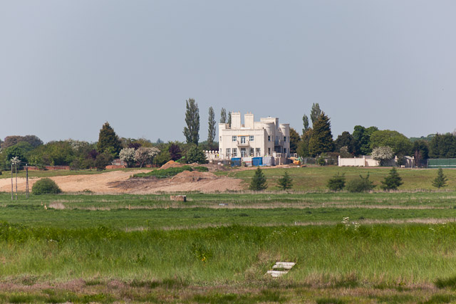
Image: © Peter Facey Taken: 28 May 2012
Looking across the River Blyth and Reydon Marshes at this large house under reconstruction. Because it is white, it is very prominent in this flat landscape. For its western elevation see Image
Images are licensed for reuse under creativecommons.org/licenses/by-sa/2.0
Image Location
Latitude
52.333225
Longitude
1.648951