Belford War Memorial
Introduction
The photograph on this page of Belford War Memorial by Graham Robson as part of the Geograph project.
The Geograph project started in 2005 with the aim of publishing, organising and preserving representative images for every square kilometre of Great Britain, Ireland and the Isle of Man.

There are currently over 7.5m images from over 14,400 individuals and you can help contribute to the project by visiting https://www.geograph.org.uk
Belford War Memorial
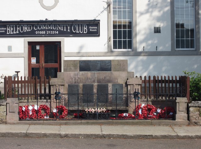
Image: © Graham Robson Taken: 23 May 2012
Belford War Memorial, situated next to the road in front of the community club on West Street. Also visible is the community club signage boasting a games room and function room. Through the large window next to the sign it is possible to make out an upper floor inserted part way up the glazing hinting that the building has been converted from a former use, possibly religious. A more extensive view of the community club can be seen in Image
Images are licensed for reuse under creativecommons.org/licenses/by-sa/2.0
Image Location
Latitude
55.5978
Longitude
-1.833031