Beaver wetland at Bamff
Introduction
The photograph on this page of Beaver wetland at Bamff by M J Richardson as part of the Geograph project.
The Geograph project started in 2005 with the aim of publishing, organising and preserving representative images for every square kilometre of Great Britain, Ireland and the Isle of Man.

There are currently over 7.5m images from over 14,400 individuals and you can help contribute to the project by visiting https://www.geograph.org.uk
Beaver wetland at Bamff
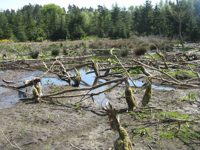
Image: © M J Richardson Taken: 26 May 2012
A mud dam at the left is part of a 100m long dam made by the beavers, and all the stumps are the result of the activity of a wild beaver family. http://www.bamff.co.uk/ http://www.scottishwildbeavers.org.
Images are licensed for reuse under creativecommons.org/licenses/by-sa/2.0
Image Location


Leaflet Map data © OpenStreetMap
Latitude
56.648953
Longitude
-3.283116