Kilburn Street corner, Belfast
Introduction
The photograph on this page of Kilburn Street corner, Belfast by Albert Bridge as part of the Geograph project.
The Geograph project started in 2005 with the aim of publishing, organising and preserving representative images for every square kilometre of Great Britain, Ireland and the Isle of Man.

There are currently over 7.5m images from over 14,400 individuals and you can help contribute to the project by visiting https://www.geograph.org.uk
Kilburn Street corner, Belfast
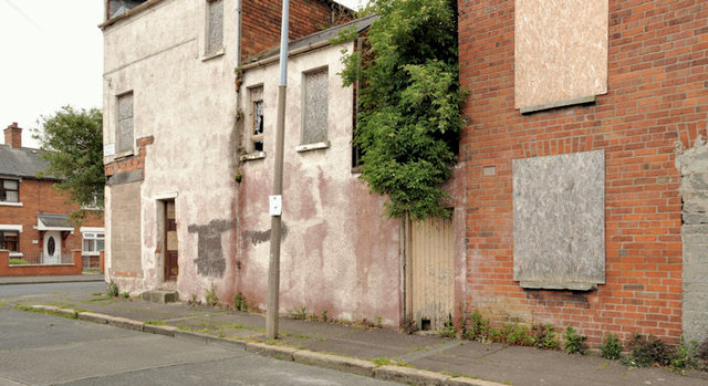
Image: © Albert Bridge Taken: 23 May 2012
Kilburn Street runs from Moltke Street to Frenchpark Street. This derelict house and shop are at the western corner of the latter. Kilburn Street had been laid out by 1901 but, by the end of WW1, it had only nine houses. Nos 1-95 had still to be built. Most of the houses remain occupied. This dereliction is an exception.
Images are licensed for reuse under creativecommons.org/licenses/by-sa/2.0
Image Location
Latitude
54.586161
Longitude
-5.955392