Crosslanes, Purton
Introduction
The photograph on this page of Crosslanes, Purton by Chris Randall as part of the Geograph project.
The Geograph project started in 2005 with the aim of publishing, organising and preserving representative images for every square kilometre of Great Britain, Ireland and the Isle of Man.

There are currently over 7.5m images from over 14,400 individuals and you can help contribute to the project by visiting https://www.geograph.org.uk
Crosslanes, Purton
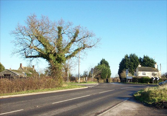
Image: © Chris Randall Taken: 17 Dec 2006
This country crossroads at the West of Purton parish includes Packhorse Lane - the road in the foreground. This minor road was once the Bristol to Oxford coach road. In 1738, George II's geographer Cowley showed it as one of only two major roads crossing North Wiltshire - the other was today's A4. The white cottage on the right was the keeper's cottage for Crosslanes Lock on the North Wilts Canal. The now-vanished canal (it closed in 1912) is the subject of an active restoration scheme. On the left is Crosslanes Farm.
Images are licensed for reuse under creativecommons.org/licenses/by-sa/2.0
Image Location
Latitude
51.606039
Longitude
-1.848335