East end of Warwick Place
Introduction
The photograph on this page of East end of Warwick Place by Robin Stott as part of the Geograph project.
The Geograph project started in 2005 with the aim of publishing, organising and preserving representative images for every square kilometre of Great Britain, Ireland and the Isle of Man.

There are currently over 7.5m images from over 14,400 individuals and you can help contribute to the project by visiting https://www.geograph.org.uk
East end of Warwick Place
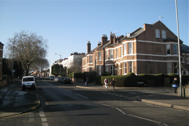
Image: © Robin Stott Taken: 15 Jan 2012
Looking uphill and west, away from Leamington town centre. The terrace on the right is post-1880 while Bertie Terrace, the white block beyond it is earlier, 1830s, built when elevated ground was a desirable place to live if you could afford to, away from the pollution, smell and disease risk of valleys and polluted watercourses. Warwick Place, laid out in the 1820s, was originally called Bertie Road. The view is from the corner of Woodbine Terrace towards the corner of Albany Terrace.
Images are licensed for reuse under creativecommons.org/licenses/by-sa/2.0
Image Location
Latitude
52.29179
Longitude
-1.543538