Nottingham - NG1 (Castle Wharf)
Introduction
The photograph on this page of Nottingham - NG1 (Castle Wharf) by David Hallam-Jones as part of the Geograph project.
The Geograph project started in 2005 with the aim of publishing, organising and preserving representative images for every square kilometre of Great Britain, Ireland and the Isle of Man.

There are currently over 7.5m images from over 14,400 individuals and you can help contribute to the project by visiting https://www.geograph.org.uk
Nottingham - NG1 (Castle Wharf)
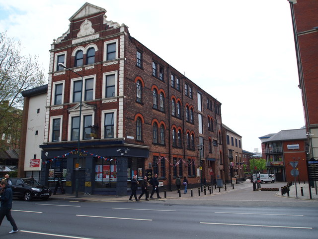
Image: © David Hallam-Jones Taken: 18 May 2012
A view of a former factory or warehouse (currently the Via Fossa restaurant and bar complex) where Castle Wharf branches off from Canal Street (A6005) and travels towards the canal side. At the pinnacle of its front elevation is the name Hardstaff. However, who Hardstaff is remains a mystery for the moment.
Images are licensed for reuse under creativecommons.org/licenses/by-sa/2.0
Image Location
Latitude
52.948487
Longitude
-1.149256