Cress Beds, Letcombe Bassett
Introduction
The photograph on this page of Cress Beds, Letcombe Bassett by Des Blenkinsopp as part of the Geograph project.
The Geograph project started in 2005 with the aim of publishing, organising and preserving representative images for every square kilometre of Great Britain, Ireland and the Isle of Man.

There are currently over 7.5m images from over 14,400 individuals and you can help contribute to the project by visiting https://www.geograph.org.uk
Cress Beds, Letcombe Bassett
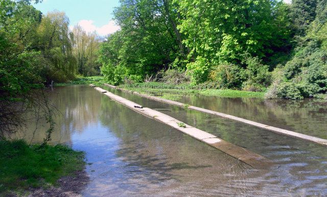
Image: © Des Blenkinsopp Taken: 12 May 2012
Like many chalk streams round here the Letcombe Brook just downstream of the source has been widened out to make cress beds. Commercial growing has long ago ceased but the cress still grows here as you can see in the upstream part of the picture. Unfortunately the very real threat of infection from Liver Fluke http://www.torrens.org.uk/FFF/Fluke.html has put people off collecting wild cress, although most food pundits seem agreed that it's fine to make soup with it, presumably because it's boiled.
Images are licensed for reuse under creativecommons.org/licenses/by-sa/2.0
Image Location
Latitude
51.564624
Longitude
-1.462272